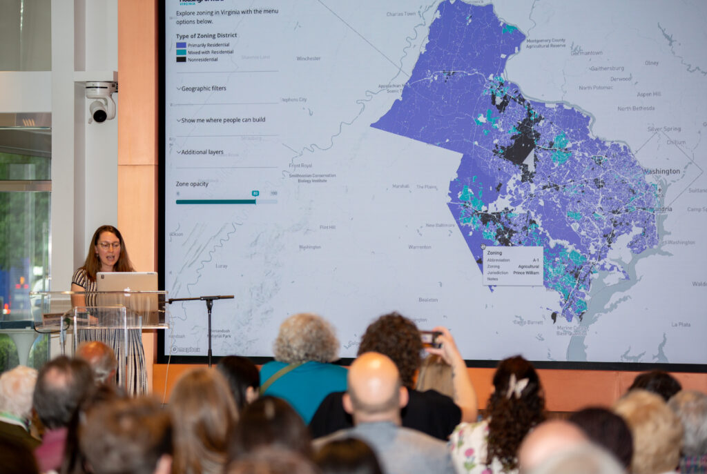
The analysis of Northern Virginia’s zoning revealed some surprising—and not-so-surprising—things.
Two weeks ago, we launched the Northern Virginia Zoning Atlas to a packed crowd at the Thomas P. Leckey Forum, hosted at the National Landing Experience Center in Arlington.
Emily Hamilton, along with Eli Kahn and Andrew Crouch of the Mercatus Center at George Mason University, revealed their findings from analysis of the Northern Virginia Zoning Atlas to nearly 100 affordable housing advocates and stakeholders from across the region.
Using the National Zoning Atlas (NZA) methodology we employed in Hampton Roads last fall, they conducted an analysis of land use regulations in the area served by the Northern Virginia Regional Commission (NVRC). Their work covered 23 jurisdictions with a total of 534 zoning districts. Here are some highlights from their policy brief.
- “Across all of Northern Virginia, 83% of developable land is categorized as primarily residential under the NZA’s typology, encompassing residential districts and agricultural districts, which generally permit housing construction by right, but excluding most mixed-use districts. The percentage of land zoned for primarily residential uses varies widely by locality, with Manassas Park being the lowest (26.4%) and Hillsboro being the highest (98.7%). Seven percent of the land in Northern Virginia is classified mixed with residential, with the remaining 9% classified as nonresidential. ”
- “The share of land zoned for exclusively single-family houses similarly varies across jurisdictions. The small towns of Clifton and Hillsboro are zoned almost entirely for single-family detached housing, whereas none of the primarily residential land in Arlington or Alexandria is restricted to single-family detached homes any longer, following 2023 reforms in both localities.”
- “Of the 20 jurisdictions in Northern Virginia, 13 have an average [minimum lot size] of less than one acre. Lovettsville has the smallest average minimum lot size of 0.16 acres [7,000 sq ft], whereas Round Hill has by far the largest with 5.24 acres [23,000 sq ft]. Nationally, the median new-construction house has a lot size of about 0.18 acres.”
- “Land on which buildings with four or more units are allowed is just 9.5% of land overall. In most Northern Virginia jurisdictions, multifamily construction is primarily confined to downtown or other commercial areas. This situation also varies significantly across jurisdictions, with 73% of Arlington allowing for these buildings but none of Clifton, Hamilton, or Hillsboro allowing for them.”
- “On 65% of the developable land in Northern Virginia, ADUs are allowed by right, including on 77% of land zoned exclusively for single-family detached housing”
There’s a lot more to digest in their policy brief, including how these regulations play a role in Northern Virginia’s increasingly expensive housing market. But with the inclusion of Northern Virginia, the Virginia Zoning Atlas now has the ability to make comparisons between two of Virginia’s planning district commissions. We can now see that Northern Virginia and Hampton Roads—although very different physically—use zoning in very similar ways.
We’d love to thank our amazing hosts at the Leckey Forum, the unified Northern Virginia Affordable Housing Alliance (NVAHA) and Alliance for Housing Solutions (AHS) for a spectacular event. And we encourage you to attend the next Leckey Forum!
In the meantime, HousingForward Virginia will be working to complete the PlanRVA region and also the Tri-Cities this summer, with an anticipated launch of this Fall. Stay tuned for more information!