
Explore the Virginia Zoning Atlas
The Virginia Zoning Atlas provides users with a comprehensive picture of zoning uses and patterns in every jurisdiction in the Commonwealth of Virginia. This multi-year project led by HousingForward Virginia and the National Zoning Atlas (NZA) allows policy makers and stakeholders across the state to visualize the impact zoning has on housing development and our communities more broadly.
The completion of the Virginia Zoning Atlas was made possible by the generous support of Capital One and Virginia Housing.
About
HousingForward Virginia joined the National Zoning Atlas (NZA) project to spearhead the creation of the Virginia Zoning Atlas (VZA). Led by Land Use Atlas, Inc., “a 501(c)(3) nonprofit organization that aims to illuminate critical information about the land use regulations that shape our lives,” the NZA aligns directly with our goals of demystifying and democratizing data about housing and the factors that contribute to the affordability crisis we continue to face.
But what is a zoning atlas?
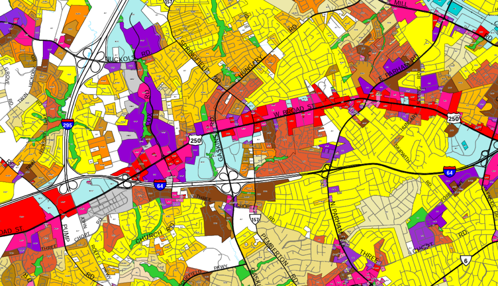
A zoning atlas is a large-scale, interactive map which displays local land use ordinance zones, or zoning districts, across all localities in a region, state, or country. Zoning atlases break down the complexity and technical aspects of zoning regulations and maps into an easy-to-use map. Instead of going back and forth between a map and legal language, you can easily see on a zoning atlas where you can build what type of housing and where that housing may be prohibited or require a public approval process.
While zoning is not a silver bullet solution to solving our affordable housing crisis, it is an important piece of the puzzle. By regulating what can be built and where, zoning directly impacts housing costs, as well as health, educational, and economic outcomes. With the Virginia Zoning Atlas, lawmakers and communities are empowered to make better informed decisions about zoning policies that lead to more abundant housing choices for everyone.
How did we get here?
Over the last decade, we have grown outreach to governments, nonprofits, and private companies with a vested interest in affordable housing across the Commonwealth. We have seen firsthand how zoning continues to be one of the greatest barriers to affordable housing in Virginia and beyond. But with the elevation of zoning to the forefront of political discussions on housing, we have come to see one big problem: understanding zoning isn’t easy.
With this challenge in mind, we made zoning an intentional priority for our organization in 2023 by engaging with the National Zoning Atlas project to begin work on the Virginia Zoning Atlas.
Taking a regional approach, we first set our sights on investigating zoning in Hampton Roads. With support from the Hampton Roads Community Foundation, Williamsburg Health Foundation, Hampton Roads Housing Consortium, Sentara, and the Mercatus Center at George Mason University, we launched the first region of the Virginia Zoning Atlas in October 2023 with the help of Christopher Newport University students. Our first regional forum brought together a group of over 60 local housing stakeholders from the region to discuss how the region zones for housing and ways in which they could increase housing opportunities in alignment with regional goals.

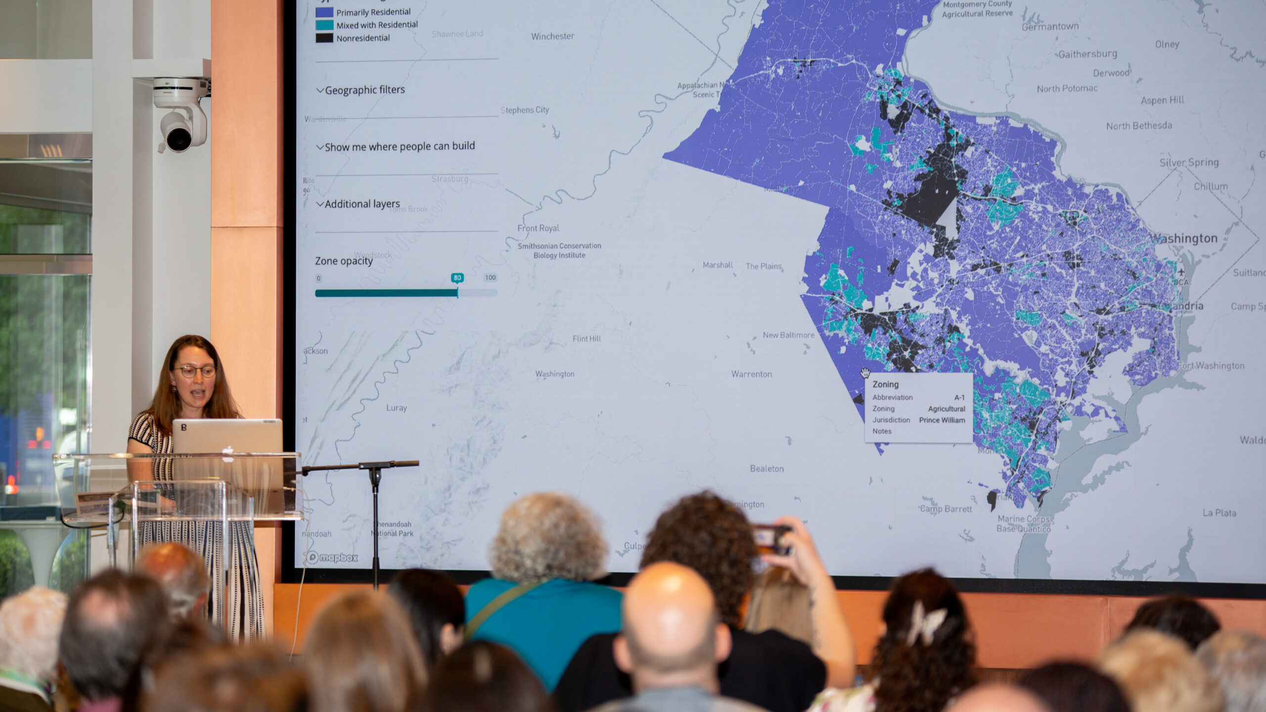
With this momentum, we set our sights on the Northern Virginia region. In early 2024, we worked closely with the Mercatus Center at George Mason University and their graduate fellows to complete the area covered by the Northern Virginia Regional Commission. As part of the Northern Virginia Affordable Housing Alliance’s Thomas P. Leckey Forum in May 2024, HFV and the Mercatus Center presented to a room of nearly 200 attendees on the impact of zoning on housing affordability in Virginia and were able to compare zoning between the Northern Virginia and Hampton Roads region.

Later that summer, HFV staff worked to complete the zoning atlas for the PlanRVA region with support from Fulton Forward Foundation, the Bob and Anna Lou Schaberg Foundation, the Community Foundation for a greater Richmond, and the League of Women Voters of Virginia. To launch the region, HFV collaborated with the Partnership for Housing Affordability and the University of Richmond to host, Reading Between the Lines: Zoning, Housing, and Education in the Richmond Region. HFV staff presented the findings of the Richmond region’s incorporation into the zoning atlas and provided a segue into a cross-institutional presentation of the findings from an update of Confronting School and Housing Segregation in the Richmond Region: Can We Learn and Live Together?, a report highlighting the intersection between housing segregation and educational outcomes. The event was attended by close to 300 attendees, including housing advocates, practitioners, and elected officials.


Appreciation for our supporters
The increasing interest in zoning across Virginia has been evident in our work and across sectors. Recognizing the importance of information and data to addressing systems-level change, Capital One awarded HousingForward Virginia with a $326,000 grant to add the remainder of the state to the Virginia Zoning Atlas.

Thanks to this significant support, we can present to you a fully completed Virginia Zoning Atlas. And for the first time ever, we have a snapshot of how the Commonwealth zones for housing.
Special thanks to Virginia Housing for their additional support of the statewide zoning report and our continued efforts to educate Virginians about the intersection of zoning and housing.

Thank you to the following individuals and funders for supporting this important work from its inception to its completion. We could not have gotten here without you:


- Robert Bennett
- Andrew Crouch
- Stephen Everard
- Joshua Ferdelman
- Emily Hamilton
- Eli Kahn
- Yasmeen Kallash-Kyler
- Orson Lange
- Milica Manojlovic
- Layne Marshall
- Audrey Morrison
- Micah Perry
- Rishab Sardana
- Kyle Walker
- Arthur Wright
How does Virginia zone for housing?
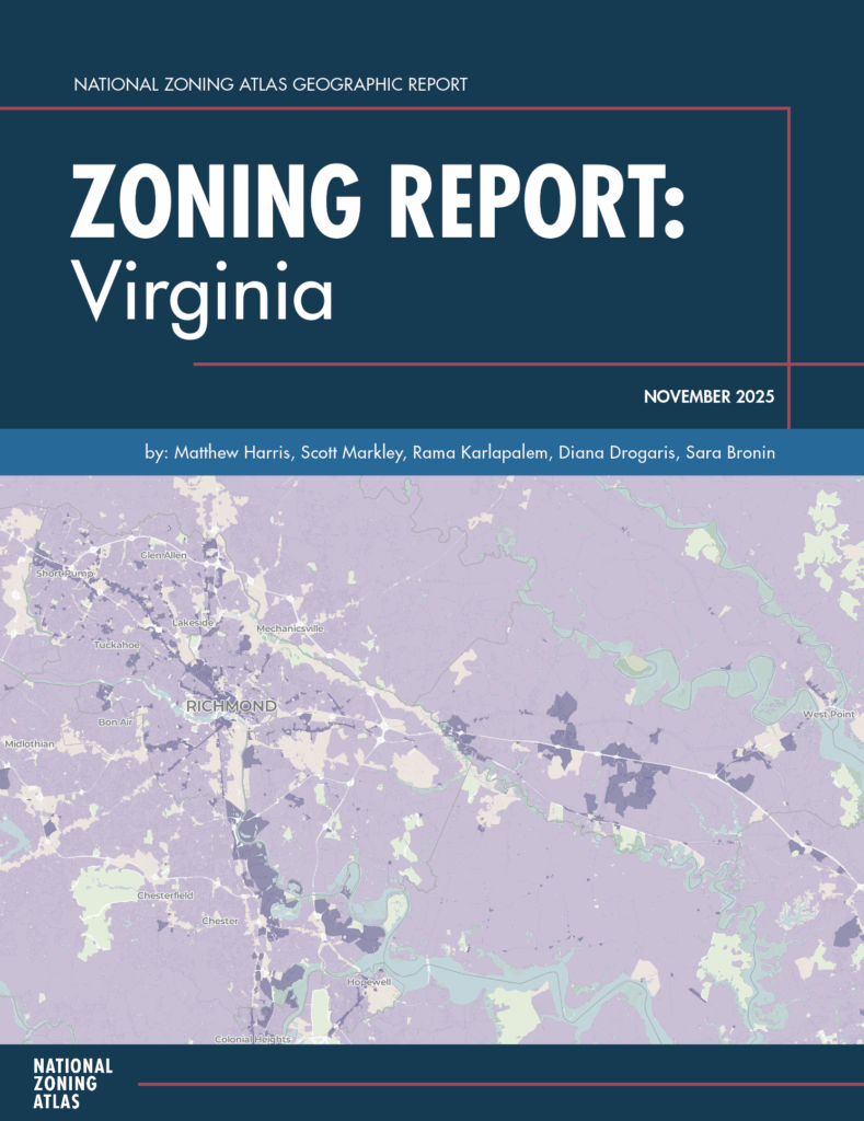
Zoning Report: Virginia is an analysis of zoning conditions in Virginia completed by the National Zoning Atlas team and funded by Virginia Housing. This is the first comprehensive report on zoning in Virginia as it relates to residential uses and serves as an important snapshot of how Virginia is or is not meeting its housing needs through land use and zoning.
KEY FINDINGS
Zoning Report: Virginia highlights information what many housing advocates have long known from experience. But that experience is now presented as fact through rigorous research and analysis. The numbers don’t lie, zoning is a major hurdle to solving Virginia’s housing affordability and supply challenges. The key findings below highlight state-level analysis. Additional regional comparisons can be found within the report.
#1 Most Virginia jurisdictions have zoning ordinances in place.
Nearly all (92%) Virginia jurisdictions with zoning authority have adopted a zoning code. And 98% of the population lives in a jurisdiction that has zoning. That means that zoning is very influential on Virginians’ choices in terms of where they can live, work, and play.
#2 Residential land is predominantly zoned for single-family housing.

Zoning in Virginia overwhelmingly favors single-family housing “as of right” or “by right” meaning it can be approved without a public hearing or special review. In fact, 98% of residential land allows single-family housing by right.
However, for people who want to live in multi-family housing, options are scarce. Just 5% of residential land allows developments with four or more homes by right. About one in five zoned jurisdictions do not allow any apartments by right at all.
#3 Minimum lot size requirements are widespread and often large.
Minimum lot sizes, which mandate homes to sit on a certain amount of land, are widespread across the state. 99% of single-family land has a minimum lot size mandate. Over half of land zoned for single-family housing requires lots of at least 40,000 square feet (roughly an acre), with nearly one-third requiring at least 80,000 square feet (about two acres).
These mandates can make in-town housing scarcer and more expensive. By spreading development farther out, these unsustainable rules also encourage environmentally destructive sprawl, which requires people to drive longer distances just to meet the basic needs of daily life.
#4 One-third of single-family land bans accessory dwelling units.

Accessory dwelling units (ADUs), also known as accessory apartments, granny flats, or in-law suites, are difficult or unlawful to pursue in much of Virginia. One-third of land zoned for single-family housing prohibits ADUs, either explicitly or by omission, with seven jurisdictions banning them entirely.
#5 Parking mandates exist on 93% of residential land.

Parking mandates, which require a minimum number of parking spaces for each new home, are widespread. These mandates can raise project costs, reduce the amount of land available for housing, and reinforce car-oriented development patterns.
What’s next?
Local communities throughout Virginia are currently considering zoning reforms, and many more will inevitably make changes to their zoning in the future. The Virginia Zoning Atlas is a point in time analysis. If you want to see consistent updates to the Virginia Zoning Atlas, please consider supporting our organization.
Support the Virginia Zoning Atlas
Consider a donation or contact us directly at admin@housingforwardva.org